
Tagging Whales Off Cape Hatteras
May 21, 2014
Learning about the movements of odontocetes.
Complete
NAS Patuxent River Marine Species Surveys
Project Objectives
Assess occurrence, seasonality, and abundance of Tursiops in the waters near NAS PAX River
Complete
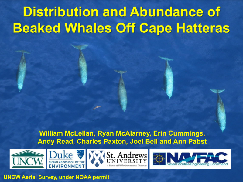
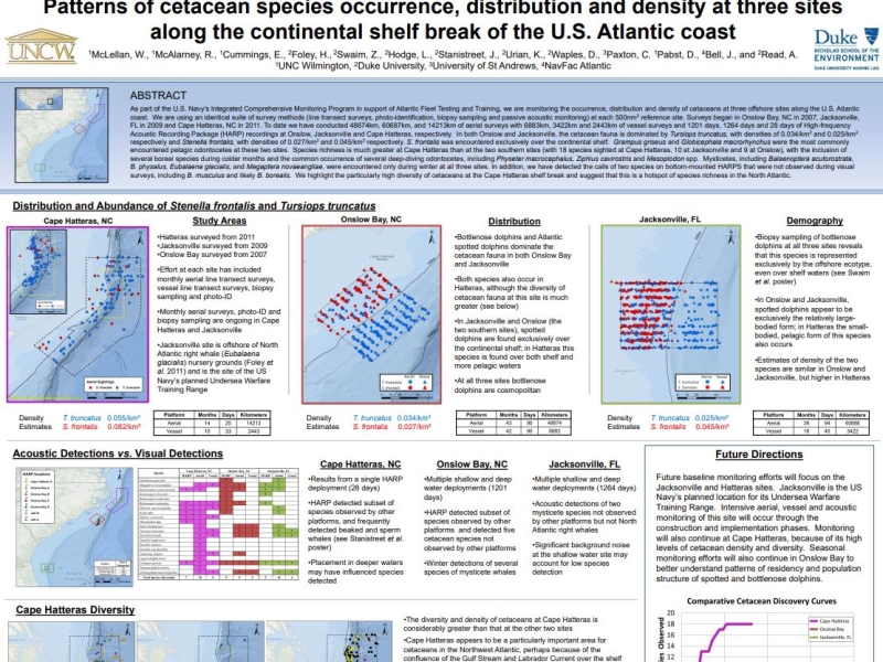
Baseline Monitoring for Marine Mammals in the East Coast Range Complexes (aerial surveys)
Project Objectives
Assess occurrence, habitat associations, and density of marine mammals and sea turtles in key areas of Navy range complexes
More details
Collapse details
Date Published:
- January 1, 2008
- 3,049.26 KB
Biogeographic patterns of Pacific white-sided dolphins based on long-term passive acoustic records.
Diversity and Distributions. 2024.
30:e13903
More details
Collapse details
Date Published:
Publication:Ocean:Species:Methods:
- June 24, 2024
This study investigates the biogeographic patterns of Pacific white-sided dolphins (Lagenorhynchus obliquidens) in the Eastern North Pacific based on long-term passive acoustic records. We aim to elucidate the ecological and behavioural significance of distinct echolocation click types and their implications for population delineation, geographic distribution, environmental adaptation and management.
More details
Collapse details
Date Published:
Ocean:Species:
- January 27, 2026
Behavior and Distribution Bull Trout off Washington
U.S. Navy Integrated Comprehensive Monitoring Program.
19th Biennial Conference on the Biology of Marine Mammals .
More details
Collapse details
Date Published:
Filesize:
- November 27, 2011
The Integrated Comprehensive Monitoring Program (ICMP) provides an overarching framework for coordination of U.S. Navy marine species monitoring. It is intended for use as a planning tool to focus Navy monitoring priorities pursuant to ESA and MMPA requirements and as an adaptive management tool to analyze and refine monitoring and mitigation techniques over time. It has been developed in direct response to Navy Range permitting requirements established in the various MMPA Final Rules, ESA consultations, and other applicable regulations. In early 2011 the Navy established a Scientific Advisory Group (SAG) consisting of experts in marine mammal ecology, passive acoustic monitoring, and cetacean behavior. The Navy convened the SAG with the initial task of evaluating current monitoring approaches under the ICMP and existing Letters of Authorization and developing objective scientific recommendations that will serve as the basis for a Strategic Plan for Navy monitoring. The Strategic Plan will be integrated as a primary component of the ICMP and provide a comprehensive 3-5 year “vision” for Navy monitoring across geographic regions - serving as guidance for determining how to most efficiently and effectively invest the U.S. Fleet marine species monitoring budget to address ICMP objectives and satisfy Marine Mammal Protection Act Letter of Authorization regulatory requirements for Fleet testing and training activities.
- 169.53 KB
Biologically Important Areas II for cetaceans within U.S. and adjacent waters - West Coast Region.
Frontiers in Marine Science. 2024.
11:1283231.
More details
Collapse details
Date Published:
Publication:Ocean:Species:
- March 11, 2024
Here we update U.S. West Coast Biologically Important Areas (BIAs) that were published in 2015 using new data and approaches. Additionally, BIAs were delineated for two species that were not delineated in the 2015 BIAs: fin whales and Southern Resident killer whales (SRKW). While harbor porpoise BIAs remained the same, substantial changes were made for other species including identifying both larger overall areas (parent BIAs) and smaller core areas (child BIAs). For blue, fin, and humpback whales we identified, delineated, and scored BIAs using the overlap between the distribution and relative density from three data sources, leveraging the strengths and weaknesses of these approaches: 1) habitat density models based on Southwest Fisheries Science Center (SWFSC) line-transect data from systematic ship surveys conducted through 2018, 2) satellite tag data from deployments conducted by three research groups, and 3) sightings of feeding behavior from non-systematic effort mostly associated with small-boat surveys for photo-identification conducted by Cascadia Research Collective. While the previous BIAs were based solely on a more subjective assignment from only the small boat sightings, here we incorporate the other two data sources and use a more rigorous, quantitative approach to identify higher density areas and integrate the data types. This resulted in larger, better-supported, objective BIAs compared to the previous effort. Our methods are also more consistent with the delineation of BIAs in other regions. For SRKWs, the parent BIA was based on a modification of the Critical Habitat boundaries defined by the National Oceanographic and Atmospheric Administration (NOAA) and the Department of Fisheries and Oceans (DFO) Canada; a core BIA highlighting areas of intensified use was identified using both NOAA’s Critical Habitat and kernel density analyses of satellite tag data. Gray whale BIAs were re-evaluated for the migratory corridor of Eastern North Pacific gray whales, for Pacific Coast Feeding Group feeding areas, and for gray whales that feed regularly in Puget Sound.
Multi-regional comparison of scarring and pigmentation patterns in Cuvier’s beaked whales.
Mammalian Biology. 2022.
102:733–750
More details
Collapse details
Date Published:
Publication:Ocean:Species:Methods:
- April 1, 2022
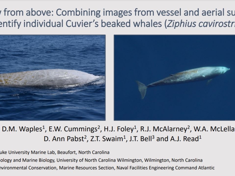
This study supports the notion that scarring density is indicative of sex for this species, improves the predictive capacity of this metric inter-regionally, and provides a reliable method to estimate the sex of whales in a typical photo-ID catalog, thus supporting vital rate assessments for this data-deficient species.
Global distribution of fin whales Balaenoptera physalus in the post-whaling era (1980–2012).
Mammal Review. 2015.
45:197-214
More details
Collapse details
Date Published:
Publication:Species:
- September 16, 2015
The global distribution of fin whales Balaenoptera physalus is not fully understood. Existing maps can be divided into two conflicting categories: one showing a continuous global distribution and another showing an equatorial hiatus (gap in the global distribution) between approximately 20°N and 20°S. Questions also remain about the seasonal distribution of fin whales. To explore the suggested equatorial hiatus and seasonal distribution patterns, we synthesised information on fin whale distribution in the post-whaling era (1980–2012) from published literature, publicly available reports and studies conducted by various organisations. We created four seasonally stratified maps showing line-transect density estimates, line-transect survey effort, acoustic detections, and sightings. An equatorial hiatus in the global distribution of fin whales during the postwhaling era is supported by numerous line-transect surveys and by the rarity of equatorial acoustic detections and sightings, and corroborated by whaling era reports, morphological analyses, and genetic analyses. Our synthesis of post-whaling era data is consistent with results from other studies indicating that fin whales are more abundant at higher latitudes during warmer months and more abundant at lower latitudes (although these latitudes are still greater than 20°) during colder months. However, our synthesis and results from other studies also indicate that some fin whales in both hemispheres remain in higher latitudes (50°–60° north or south) during colder months and in lower latitudes (to approximately 20°–30° north or south) during warmer months, indicating that seasonal fin whale movements differ from the seasonal migrations of blue whales Balaenoptera musculus and humpback whales Megaptera novaeangliae. Our maps of global fin whale distribution provide a comprehensive picture of current knowledge and highlight important geographical and temporal data gaps. Surveys should be conducted within the identified data gaps in order to increase fine-scale spatial and temporal knowledge of distribution patterns, improve fin whale taxonomy, and identify areas of elevated fin whale densities that may require management of threats, such as ship strikes.
Ecological inferences about marine mammals from passive acoustic data.
Biological Reviews. 2023.
98:1633–1647
More details
Collapse details
Date Published:
Publication:Methods:
- May 4, 2023
Monitoring on the basis of sound recordings, or passive acoustic monitoring, can complement or serve as an alternative to real-time visual or aural monitoring of marine mammals and other animals by human observers. Passive acoustic data can support the estimation of common, individual-level ecological metrics, such as presence, detection-weighted occupancy, abundance and density, population viability and structure, and behaviour. Passive acoustic data also can support estimation of some community-level metrics, such as species richness and composition. The feasibility of estimation and certainty of estimates is highly context dependent, and understanding the factors that affect the reliability of measurements is useful for those considering whether to use passive acoustic data. Here, we review basic concepts and methods of passive acoustic sampling in marine systems that often are applicable to marine mammal research and conservation. Our ultimate aim is to facilitate collaboration among ecologists, bioacousticians, and data analysts.
Automated Acoustic Tracking of a Sperm Whale (Physeter macrocephalus) using a Wide Baseline Array of Sensors.
FUSION. 2024.
1–7
More details
Collapse details
Date Published:
Publication:Species:Methods:
- July 11, 2024
Underwater acoustics is a key tool for monitoring marine environments and understanding marine mammal populations. However, extracting meaningful information from passive acoustic recordings poses challenges due to overlapping signals, species-specific vocalization behavior, and missed and false detections. Many methods for marine mammal tracking and localization rely on human operators for signal detection and measurement association, which is a subjective and laborious process. In this paper we demonstrate a fully automated framework for marine mammal tracking and localization using wide-baseline arrays based on a multi-target Bayesian approach. Leveraging a “track-before-localize” strategy and fusing information from multiple sensors and virtual sensors, the framework eliminates the need for detection, classification, or association steps, thereby improving efficiency and objectivity. The feasibility and performance of the proposed framework are demonstrated using real-world data of a clicking sperm whale from the US Navy’s AUTEC test range.
SMART SEED Annual Review. Tysons, Virginia .
Oral Presentation, Effects of Sound on Marine Mammals, Beaufort, North Carolina, 15-18 March 2022 .
More details
Collapse details
Date Published:
- March 15, 2022
Marine mammals and sonar: Dose-response studies, the risk-disturbance hypothesis and the role of exposure context.
Journal of Applied Ecology. 2017.
55:396-404
More details
Collapse details
Date Published:
Publication:Methods:
- June 19, 2017
Behavioural response studies have greatly improved our understanding of the potential effects of naval sonar on marine mammals. Despite data gaps, we believe a dose-response approach within a risk-disturbance framework will enhance our ability to predict responsiveness for unstudied species and populations. We advocate for (1) regulatory frameworks to utilize peer-reviewed research findings when making predictions of impact, (2) regulatory frameworks to account for the inherent uncertainty in predictions of impact and (3) investment in monitoring programmes that are both directed by recent research and offer opportunities for validation of predictions at the individual and population level.
Beaked Whale Behavioral Responses to Navy Mid-Frequency Active Sonar.
Springer Cham. 2023.
Living reference work entry
More details
Collapse details
Date Published:
Publication:Ocean:Methods:
- August 22, 2023
Although beaked whales remain a cryptic and elusive family, much has been learned about their dive and foraging behavior in the last few decades through the use of passive acoustic monitoring (PAM) and a variety of tagging methods. Species-specific echolocation pulses can be used to acoustically track individuals and groups, and biologging tags provide information on dive and movement behavior. These technologies have also provided a window into how beaked whales behaviorally respond to Navy mid-frequency active sonar, which in turn may elucidate maladaptive behaviors that could lead to stranding. This chapter reviews existing knowledge about beaked whale behavioral responses to anthropogenic sound sources in general, and to Navy sonars in particular. By understanding the breadth of ways beaked whales behaviorally respond, the scientific community can continue to work toward recognizing and mitigating responses that could lead to stranding, as well as determining the population-level implications of impacts on individuals.
The Effects of Noise on Aquatic Life, Berlin, Germany, 10-15 July 2022 .
Echolocation behavior of endangered fish-eating killer whales (Orcinus orca) recorded from digital acoustic recording tags (DTAGs): Insight into subsurface foraging activity.
Journal of the Acoustical Society of America. 2016.
140(4, Part 2):3130
More details
Collapse details
Date Published:
Publication:Species:Methods:
- October 1, 2016
Killer whales are apex predators with diet specializations that vary among ecotypes. Resident killer whales use broadband echolocation clicks to detect and capture fish prey in their underwater environment. Here, we describe the echolocation behavior of endangered Southern Resident killer whales using DTAGs to determine subsurface foraging activity and to assess the effects of vessel and noise on foraging behavior. We deployed 29 DTAGs on individually-identified killer whales and collected complimentary field data over four seasons in summer habitat. DTAGs had two hydrophones that each recorded sound at sampling rates of 192 or 240 kHz, and other sensors to reconstruct whale movement. Prey remains were opportunistically collected during tag deployments to validate feeding. Echolocation signals of the tagged whale were inferred from spectral content and the angle of arrival that corresponded to tag placement. Preliminary results reveal that individuals produced steady click trains during shallow dives then dove to deeper depths while clicking at higher repetition rates that graded into bottom-associated low-level buzzes before ascent occurred. These results, together with movement data, are reliable subsurface foraging cues in this endangered population that can be used to assess vessel effects on foraging behavior.
More details
Collapse details
Date Published:
Ocean:
- January 1, 2025
Statistical Analysis of Marine Mammal Stranding Events
An at-sea assessment of Argos location accuracy for three species of large whales, and the effect of deep-diving behavior on location error.
Animal Biotelemetry. 2020.
10.1186/s40317-020-00207-x
More details
Collapse details
Date Published:
Publication:Ocean:Species:Methods:
- June 7, 2020
Argos satellite telemetry is used globally to track terrestrial and aquatic megafauna, yet the accuracy of this system has been described empirically only for a limited number of species. We used Argos-linked archival tags with Fastloc GPS deployed on free-ranging sperm (Physeter macrocephalus), blue (Balaenoptera musculus), and fin (B. physalus) whales to derive empirical estimates of Argos location errors for these species, examine possible behavior-related differences, and test the effect of incorporating species-specific error parameters on performance of a commonly used movement model.
Echolocation click discrimination for three killer whale ecotypes in the Northeastern Pacific.
Journal of the Acoustical Society of America. 2022.
151(5):3197-3206
More details
Collapse details
Date Published:
Publication:Ocean:Species:Methods:
- May 12, 2022
Three killer whale ecotypes are found in the Northeastern Pacific: residents, transients, and offshores. These ecotypes can be discriminated in passive acoustic data based on distinct pulsed call repertoires. Killer whale acoustic encounters for which ecotypes were assigned based on pulsed call matching were used to characterize the ecotype-specific echolocation clicks. Recordings were made using seafloor-mounted sensors at shallow (∼120 m) and deep (∼1400 m) monitoring locations off the coast of Washington state.
More details
Collapse details
Date Published:
Filesize:
- August 1, 2017
This report details the results of three years (2014-2016) of tracking data for blue and fin whales (Balaenoptera musculus and B. physalus, respecitvely) tagged in southern California waters, as well as one season of tracking data for humpback whales (Megaptera novaeangliae) tagged off the Oregon coast. T
- 37,464.48 KB
More details
Collapse details
Date Published:
Filesize:
- October 1, 2018
OSU conducted a 4-year (2014–2017) tagging and tracking study on eastern North Pacific blue whales and fin whales to determine their movement patterns, occurrence, and residence times within U.S. Navy training and testing areas, as well as NMFS-identified BIAs. Tracking periods ranged from 0.6 to 283.8 d. Blue whale locations ranged from the northern tip of Vancouver Island, British Columbia, to very close to the equator, while fin whales were from Haida Gwaii, British Columbia, to the northern coast of Baja California, Mexico.
- 15,319.91 KB
More details
Collapse details
Date Published:
Filesize:
- January 15, 2016
In 2015 Oregon State University’s Marine Mammal Institute (OSU/MMI) conducted a second year of tagging operations in support of the United States (U.S.) Navy’s marine mammal studies in the offshore waters of the Southern California Range Complex (SOCAL) portion of the Hawaii-Southern California Training and Testing Study Area as well as the existing Northwest Training Range Complex (NWTRC), Naval Undersea Warfare Center Keyport Range Complex (together known as the Northwest Training and Testing Study Area). The focus of these studies is to address key science objectives the Navy has committed to complete as part of regulatory requirements promulgated from the National Marine Fisheries Service.
- 3,727.83 KB
More details
Collapse details
Date Published:
Filesize:
- January 1, 2017
Blue and fin whale tagging efforts took place off the southern and central coast of California during one 30-day cruise aboard the research vessel (R/V) Pacific Storm. Nineteen tags were deployed on blue whales (11 LO, 8 DM) between July 14 and August 3, 2016.
- 4,304.31 KB
More details
Collapse details
Date Published:
Filesize:
- January 1, 2013
Mid-frequency active sonar (MFAS) includes a variety of signal types that generally range between 1 kHz and 10 kHz and consist of either constant-frequency or frequency-modulated signals, or some combination of both. "SonarFinder" is a semi-automated MATLAB-based program that is designed to detect and provide metrics on MFAS and assess its effects on marine mammal acoustic behaviors. SonarFinder is intended for use on large acoustic datasets, such as those collected from autonomous recorders and other passive acoustic systems. This software can be used to analyze any acoustic recordings saved in standard .wav format. It can batch process (i.e. unattended) all .wav files in a user-specified directory, and output all detector results to a set of excel spreadsheets. SonarFinder uses a 3-stage process to differentiate "true" sonar from noise and transient signals (i.e. false positives). Each stage uses different criteria to detect potential sonar signals. Only detections which pass the criteria of all three stages are logged as sonar. SonarFinder measures frequency and time domain variables to characterize and classify sonar pings. It also has the capability of comparing detections to a spreadsheet of known sonar events (e.g. a previously annotated dataset) to evaluate the performance of the parameter settings selected for a dataset. In addition, output from the detector can be automatically compared to a user-supplied log of marine mammal detections to investigate correlations between a biological parameter and the sound pressure level of the recording.
- 1,473.89 KB
Continuous-time modelling of behavioural responses in animal movement.
Annals of Applied Statistics. 2023.
17(4):3570–3588
More details
Collapse details
Date Published:
Publication:Methods:
- December 1, 2023
We propose varying-coefficient stochastic differential equations (SDEs) as a flexible framework to model such data with two components: (1) time-varying baseline dynamics, modelled with nonparametric or random effects of time-varying covariates, and (2) a nonparametric response model, which captures deviations from baseline. SDEs are specified in continuous time, which makes it straightforward to analyse data collected at irregular time intervals, a common situation for animal tracking studies. We describe how the model can be embedded into a state-space modelling framework to account for measurement error. We present inferential methods for model fitting, model checking, and uncertainty quantification (including on the response model). We apply this approach to two behavioural response study data sets on beaked whales: a satellite track and high-resolution depth data. Our results suggest that the whales’ horizontal movement and vertical diving behaviour changed after exposure to the sound source, and future work should evaluate the severity and possible consequences of these responses.
More details
Collapse details
Date Published:
Filesize:
- January 1, 2019
The goal of this project, therefore, is to better understand GFS abundance, behavior, distribution, and habitat use and determine the degree to which this recovering population uses U.S. Navy training and testing ranges in the North East Pacific. There are two principle components of this project: (1) updating overall population information for GFS, and (2) tracking the at-sea movement patterns of GFS using satellite transmitters.
- 2,935.44 KB
More details
Collapse details
Date Published:
Filesize:
- November 30, 2019
The goal of this project, therefore, is to better understand Guadalupe fur seal abundance, behavior, distribution, and habitat use and determine the degree to which this recovering population uses U.S. Navy training and testing ranges in the North East Pacific.
- 8,250.12 KB
More details
Collapse details
Date Published:
Filesize:
- January 21, 2020
Guadalupe fur seals are listed as threatened under the U.S. Endangered Species Act and endangered under Mexican law. However, prior to the first year of this study in 2018, the last full census for this species was in 2010, making it difficult to develop current and accurate population estimates and trends. To determine the degree to which this recovering population uses U.S. Navy training and testing ranges in the North Pacific, updated population information for Guadalupe fur seals is needed in addition to tracking at-sea movement patterns using satellite transmitters. Similar to 2018, during the 2019 summer breeding season, direct counts of Guadalupe fur seals were conducted at Guadalupe Island and San Benito Archipelago, México.
- 1,823.98 KB
More details
Collapse details
Date Published:
Filesize:
- December 10, 2020
As the population of Guadalupe fur seals (Arctocephalus townsendi or A. philippii townsendi) continues to recover, this species, which is listed as threatened in the U.S. and endangered in México, is increasingly common in their historical range extending from central México to Washington State. Relatively little is known about this species compared with other pinnipeds that occur in the California Current System. Accurate and current population estimates are lacking because censuses at the only rookery have been sparse and sporadic, and there is a paucity of data on at-sea movements because few individuals have been tracked using telemetry instruments. Therefore, the goal of this multiyear study was to better understand Guadalupe fur seal abundance, behavior, distribution, and habitat use, and to determine the degree to which this recovering population uses U.S. Navy training and testing ranges in the Northeast Pacific.
- 4,612.11 KB
Marine seismic surveys and ocean noise: Mitigation, monitoring and a plan for international management.
21st Biennial Conference on the Biology of Marine Mammals .
More details
Collapse details
Date Published:
Filesize:
- December 13, 2015
Given the extent of seismic surveys and their potential negative environmental impacts, there is need for systematic planning and operational standards to minimize or eliminate impacts, especially in sensitive areas. Mitigating immediate potential impacts is important, but monitoring for short- as well as long-term impacts is essential. Risks from cumulative, synergistic, and synchronous effects, which may occur over large spatial and temporal scales, are rarely considered sufficiently in environmental assessments; regulatory requirements vary widely from one country/jurisdiction to another. We describe a series of basic elements for responsibly conducting marine seismic surveys or other major noise generating activity: obtaining consistent baseline ecological data; substantial advance planning, communication, transparency and critical review; integrated acoustic and visual monitoring during operations; and systematic analysis and sharing of results to inform future planning and mitigation. These programs need to be adaptive and not all elements are needed in every case. In addition to these elements, given the international and transboundary nature of ocean noise generally, we assert the urgent need for a consistent worldwide approach to address this issue. Such a framework could involve the creation of a new international instrument or, preferably, the extension of an existing one (e.g. International Convention on the Prevention of Pollution from Ships - MARPOL). The broad issue of ocean noise is being discussed and precedents for such international instruments exist within a range of intergovernmental organizations (e.g., CBD, IMO, CMS and IWC). In addition, the US requires consideration of noise in the preparation of environmental impact statements and the EU has recognized ocean noise as a pollutant and an indicator of environmental quality under its Marine Strategy Framework Directive. The time is ripe and the need is great to consolidate such initiatives to develop a consistent, effective, science-based international regulatory framework to address the issue of ocean noise.
- 92.81 KB
More details
Collapse details
Date Published:
Filesize:
- January 1, 2013
ROCCA (Real-time Odontocete Call Classification Algorithm) is a delphinid whistle classification algorith that is available as a module in PAMGuard. PAMGuard is an open-source, freely available, suite of passive-acoustic monitoring software applications for marine mammals that was developed and is maintained by Dr. Doug Gillespie at the University of St. Andrews, Scotland (Gillespie et al 2008). PAMGuard is available for download at www.pamguard.org. ROCCA classifies delphinid whistles based on spectrographic measurements taken from extracted whistle contours. ROCCA can be used to extract whistle contours from spectrograms using either a semi-automated method (via the ROCCA interactive contour-extraction graphical user interface [GUI]), or a fully automated method (via the Whistle and Moan Detector [WMD] module in PAMGuard). ROCCA measures 50 different features from the extracted whistle contour, including duration, frequencies, slopes and variables describing the shape of the whistle. The measured features are then used as inputs for a random forest based classifier that is used to classify each whistle to species. ROCCA groups individual whistle classifications based on user-defined encounters. An encounter is defined as a collection of whistles that are assumed to have been produced by a discrete school of dolphins. ROCCA classifies the encounter to one of several species based on results of the random forest analysis summed over all of the whistles in that encounter. ROCCA output files include a clip of the whistle being classified (Windows Wave [.wav] file), a list of extracted time-frequency pairs for the whistle contour (Comma Separated Values [.csv] format), the measured features and classification results for each individual whistle (.csv format), and overall results for each encounter (.csv format).
- 1,534.70 KB
Intra-specific variability in delphinid whistle structure: Implications for acoustic species identification.
21st Biennial Conference on the Biology of Marine Mammals .
More details
Collapse details
Date Published:
Filesize:
- December 13, 2015
Passive acoustic methods are commonly used to study and monitor marine mammals. Identifying sounds recorded from marine mammals to species can be challenging and often necessitates using statistically based classification analysis. Training and testing classifiers requires visually validated, single-species recordings and large amounts of data, which can be difficult to obtain. Combining data recorded from different locations to train classifiers would allow for larger sample sizes, however, due to geographic variation in signal structure, it has been suggested that classifiers should be trained using recordings made in the locations where they will be used. To examine the effect of geographic variation on classifier performance, whistles were measured from three delphinid species that occur in both the eastern tropical Pacific (ETP) and northwest Atlantic (NWAt) oceans: striped dolphins (Stenella coeruleoalba), bottlenose dolphins (Tursiops truncatus), and short-finned pilot whales (Globicephala macrorhynchus).
- 113.49 KB
Does depth matter? Investigating the effect of recording depth on delphinid whistle characteristics and classifier performance.
Journal of the Acoustical Society of America. 2016.
139(4,Part 2):2060-2061
More details
Collapse details
Date Published:
Publication:Methods:
- April 1, 2016
Seafloor acoustic recorders are commonly used to obtain information about cetaceans, as they allow data to be collected for long periods without the presence of a human operator. Recordings collected using seafloor instruments do not have associated visual observations, so species must be identified based on their calls. Visually validated acoustic recordings are necessary for training acoustic species classifiers and so most are trained using data collected near the sea surface. The suitability of using classifiers trained using surface recordings to analyze recordings obtained at depth is unknown. To investigate this, we used a vertical array of four Ecological Acoustic Recorders (EARs) spaced 90 m apart to record delphinids at different depths. The same whistles were measured from each EAR and median values of 17 spectrographic variables were compared among EARs for six acoustic encounters. For five of the encounters, there were significant differences in whistle variables among EARs, most commonly in frequency variables. When a random forest classifier was used to identify these whistles to species, the same five encounters were classified as different species when recorded at different depths. These results suggest that caution should be taken when applying classifiers developed using surface data to whistles recorded at depth.
Automatic detection and characterization of mid-frequency active sonar and its impact on marine mammal vocalizations.
6th International Workshop on Detection, Classification, Localization and Density Estimation of Marine Mammals using Passive Acoustics .
More details
Collapse details
Date Published:
Filesize:
- June 12, 2013
Mid-Frequency Active (MFA) sonar includes a variety of constant-frequency and frequencymodulated signal types, ranging between 1 kHz and 10 kHz. Studies have shown correlations between MFA sonar and marine mammal strandings, behavioral reactions, and potential temporary threshold shifts. Presently, there are no standardized methods available for detection and quantification of sonar signals, or assessment of their impacts on marine mammal acoustic behavior. ‘SonarFinder’ is a semi-automated Matlab-based program we have developed to fill that need. SonarFinder is intended for use on large acoustic datasets such as those collected from autonomous recorders and other passive acoustic systems. It can batch process all wav-format files in a folder unsupervised, and save results to multiple spreadsheets. SonarFinder uses a 3-step testing scheme to separate true sonar from noise and transients. Step 1 uses an amplitude threshold, step 2 an ‘amplitude integrated over time’ threshold, and step 3 the power spectral density of a predefined band. Only detections which pass all three steps are logged as sonar. Measurements in the frequency and time domains are used to characterize and classify sonar pings. Output from the detector can be automatically compared to a user-supplied list of marine mammal detections. A dose response parameter and the probabilities of animal vocalizations occurring in the presence and absence of sonar are calculated based on this comparison to allow assessment of the relationship between sonar presence and marine mammal acoustic behavior. We tested SonarFinder using several autonomous recorder datasets. Precision and recall for these tests ranged from .56 to .71 and .33 to .89, respectively. Based on these results, SonarFinder is a valuable tool for quantifying the presence of sonar with respect to marine mammal vocalizations. The output of SonarFinder will allow a deeper understanding of how marine mammals may be responding to this anthropogenic sound.
- 189.34 KB
Society for Mexican Marine Mammalogy, May 2023, Manzanillo, Mexico .
More details
Collapse details
Date Published:
- May 1, 2023
Geographic variation in Risso's dolphin echolocation click spectra.
Journal of the Acoustical Society of America. 2017.
142:599-617
More details
Collapse details
Date Published:
- August 4, 2017
More details
Collapse details
Date Published:
Filesize:
- August 1, 2014
Naval activities such as ordnance disposal, demolition and requisite training, can involve detonation of small explosive charges in shallow water that have the potential to harm nearby marine life. Measurements of the underwater sound generated by sub-surface explosions were collected as part of a naval training exercise. In this thesis the noise levels from these explosions will be investigated using peak pressure, sound exposure level and energy spectral density. Measurements of very-low frequeny Scholte interface waves will also be presented and used to investigate elastic parameters in the sediment.
- 10,663.43 KB
Streamlining High-Volume Data Acquisition, Analysis and Tracking of Marine Mammals with Highly Configurable, Standards-based Software.
27th Conference of the European Cetacean Society .
More details
Collapse details
Date Published:
Filesize:
- April 8, 2013
To meet the need for all-in-one, user-configurable, user-friendly combined survey/behavioral data collection and analysis software, the Mysticetus Observation Platform (Mysticetus) has been designed, tested and field deployed in numerous aerial, vessel and shore-based surveys for marine mammals around the world. Mysticetus provides real-time distance and bearing to a sighting by synthesizing real-time Global Positioning System (GPS) data with the declination angles (converted to distance) and times of sightings. This feature has been critical to quickly relocating sightings, particularly in higher Beaufort conditions. Relative location of the sighting to the aircraft/vessel is continuously displayed on a map on a laptop, and automatically adapts to changing distances and headings of the platform. Real-time bathymetric data are displayed, and can be used to determine numerous sea-floor characteristics in the survey area (e.g., depth, slope, aspect). Mysticetus also triangulates, in real-time, directional acoustic data received via radio from sonobuoys, allowing correlation of behavior with vocalizations, both in the field and during post-processing. Other post-survey analysis tools include automated tabular summaries of effort and sightings, Google Earth 3-D track display, distance-to-shore calculations, etc., that greatly reduce data, GIS and analysis efforts. Mysticetus is unique from other available similar software because it is easily configured by the user to select data fields/types, units, etc., and can record, summarize, analyze and plot data as indicated by the user.
- 639.51 KB